Geolocate

Cambridge topographic map

Click on the map to display elevation.

About this map

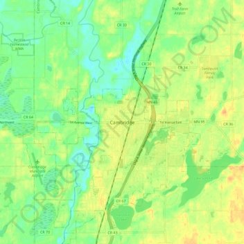
Name: Cambridge topographic map, elevation, terrain.

Location: Cambridge, Isanti County, Minnesota, 55008, United States (45.53274 -93.26439 45.61274 -93.18439)

Average elevation: 948 ft

Minimum elevation: 896 ft

Maximum elevation: 1,001 ft

Isanti County trails, hiking, mountain biking, running and outdoor activities

Gear up for your next adventure:

🧢Sun Protection Hats - Wide-brimmed and UPF-rated hats for high-altitude sun safety
🌐World Map Poster - Decorative world maps with topographic info
🛰️Satellite Messengers - Emergency SOS and two-way messaging for off-grid adventures
💧Water Filtration Bottles - Safely drink from streams and lakes while exploring
👟Men's Trail Runners - Lightweight footwear for fast-paced exploration and light hiking

As an Amazon Associate, this site earns from qualifying purchases at no extra cost to you.