
Smoky Lake topographic map
Interactive map
Click on the map to display elevation.
About this map
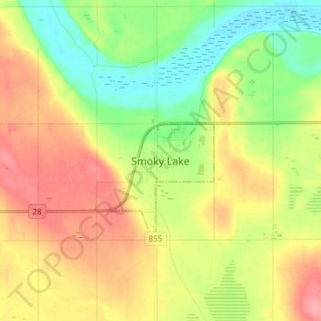
Name: Smoky Lake topographic map, elevation, terrain.
Location: Smoky Lake, Town of Smoky Lake, Alberta, T0A 3C0, Canada (54.07306 -112.51361 54.15306 -112.43361)
Average elevation: 2,070 ft
Minimum elevation: 1,932 ft
Maximum elevation: 2,231 ft