Geolocate

Krishnagar topographic map

Click on the map to display elevation.

About this map

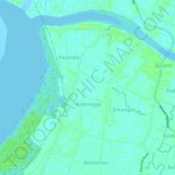
Name: Krishnagar topographic map, elevation, terrain.

Location: Krishnagar, Basanti, South 24 Parganas, West Bengal, India (22.17331 88.67513 22.21331 88.71513)

Average elevation: 10 ft

Minimum elevation: -3 ft

Maximum elevation: 33 ft

Gear up for your next adventure:

🛡️Bear Spray Outdoor - Protection in bear country hikes
🎒Day Hiking Backpack - Lightweight backpack perfect for day trips and outdoor adventures
🕶️GPS Smartphone Mount - Secure mount for phone navigation
📚Navigation Handbooks - Master the art of reading topographic maps and using a compass
🏥Hiking First Aid Kits - Comprehensive medical kits for remote trail injuries

As an Amazon Associate, this site earns from qualifying purchases at no extra cost to you.