Geolocate

Harmony topographic map

Click on the map to display elevation.

About this map

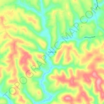
Name: Harmony topographic map, elevation, terrain.

Location: Harmony, Roane County, West Virginia, 25243, United States (38.66620 -81.49901 38.70620 -81.45901)

Average elevation: 906 ft

Minimum elevation: 696 ft

Maximum elevation: 1,132 ft

Roane County trails, hiking, mountain biking, running and outdoor activities

Gear up for your next adventure:

🪶LED Camping Lantern - Bright lantern for camp lighting
Backpacking Tent - Lightweight and durable tent for multi‑day hikes
🎒Waterproof Dry Bags - Keep your electronics and maps dry inside your pack
🧥Men's Rain Shells - Premium waterproof and breathable jackets for mountain weather
📷Action Camera - Capture your outdoor adventures in HD

As an Amazon Associate, this site earns from qualifying purchases at no extra cost to you.