
萨哈尔村 topographic map
Interactive map
Click on the map to display elevation.
About this map
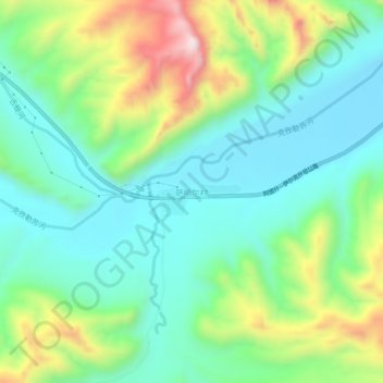
Name: 萨哈尔村 topographic map, elevation, terrain.
Location: 萨哈尔村, 乌恰县, 克孜勒苏柯尔克孜自治州, 新疆维吾尔自治区, 中国 (39.75160 74.16101 39.79160 74.20101)
Average elevation: 8,947 ft
Minimum elevation: 8,415 ft
Maximum elevation: 10,177 ft
Other topographic maps
Click on a map to view its topography, its elevation and its terrain.