Geolocate

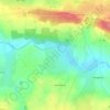
Kerbihan topographic map

Click on the map to display elevation.

About this map

Name: Kerbihan topographic map, elevation, terrain.

Location: Kerbihan, Saint-Jean-Brévelay, Pontivy, Morbihan, Bretagne, France métropolitaine, 56660, France (47.83435 -2.74118 47.87435 -2.70118)

Average elevation: 351 ft

Minimum elevation: 174 ft

Maximum elevation: 509 ft

Other topographic maps

Click on a map to view its topography, its elevation and its terrain.
56660

France > Bretagne > Morbihan > Saint-Jean-Brévelay > Kervenic

Average elevation: 282 ft

Gear up for your next adventure:

🪶Camping Sleeping Pad - Comfortable sleeping pad for backpacking
🎒Gear Packing Cubes - Organize your backpack efficiently
🧼Biodegradable Camping Soap - Eco‑friendly soap for outdoor hygiene
🪶Multi‑Purpose Knife - Useful blade for camp and trail
🧭GPS Watch Accessories - Bands and chargers for GPS watches

As an Amazon Associate, this site earns from qualifying purchases at no extra cost to you.