Geolocate

Witcham topographic map

Click on the map to display elevation.

About this map

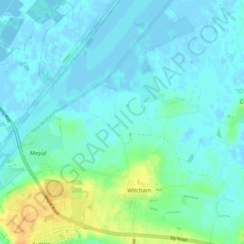
Name: Witcham topographic map, elevation, terrain.

Location: Witcham, East Cambridgeshire, Cambridgeshire, Cambridgeshire and Peterborough, England, United Kingdom (52.38859 0.12261 52.43748 0.18506)

Average elevation: 20 ft

Minimum elevation: -20 ft

Maximum elevation: 95 ft

Other topographic maps

Click on a map to view its topography, its elevation and its terrain.

Gear up for your next adventure:

🔭Telescopic Hiking Pole - Adjustable pole for hiking stability
📱Heavy-Duty Phone Cases - Drop-proof and waterproof protection for outdoor navigation
📶Vehicle Signal Boosters - Improve reception in rural areas while driving to trailheads
🥤Water Filter Bottle - All‑in‑one filter bottle for safe hydration
🌄Hiking Binoculars - Compact binoculars for scenic views and trail spotting

As an Amazon Associate, this site earns from qualifying purchases at no extra cost to you.