
Pohénégamook topographic map
Interactive map
Click on the map to display elevation.
About this map
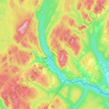
Name: Pohénégamook topographic map, elevation, terrain.
Average elevation: 1,253 ft
Minimum elevation: 627 ft
Maximum elevation: 2,172 ft
Other topographic maps
Click on a map to view its topography, its elevation and its terrain.
Packington
Canada > Quebec > Témiscouata
Packington, Témiscouata, Bas-Saint-Laurent, Quebec, Canada
Average elevation: 1,020 ft