
Mayo topographic map
Click on the map to display elevation.
About this map
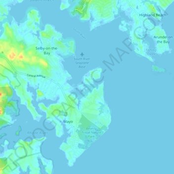
Name: Mayo topographic map, elevation, terrain.
Location: Mayo, Anne Arundel County, Maryland, United States (38.86649 -76.55288 38.93641 -76.47050)
Average elevation: 10 ft
Minimum elevation: -10 ft
Maximum elevation: 98 ft
Anne Arundel County trails, hiking, mountain biking, running and outdoor activities