
Rickenbach topographic map
Click on the map to display elevation.
About this map
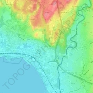
Name: Rickenbach topographic map, elevation, terrain.
Average elevation: 1,404 ft
Minimum elevation: 1,283 ft
Maximum elevation: 1,690 ft
Other topographic maps
Click on a map to view its topography, its elevation and its terrain.
88131
Deutschland > Bayern > Landkreis Lindau > Lindau (Bodensee) > Schönau
Average elevation: 1,463 ft
BSB-Hafen Lindau (Bodensee)
Deutschland > Bayern > Landkreis Lindau > Lindau (Bodensee)
Average elevation: 1,296 ft