
Esk Valley topographic map
Interactive map
Click on the map to display elevation.
About this map
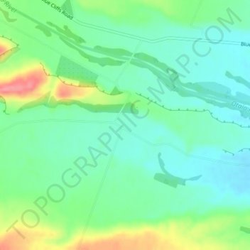
Name: Esk Valley topographic map, elevation, terrain.
Location: Esk Valley, Waimate District, Canterbury, New Zealand (-44.53638 171.07178 -44.51638 171.09178)
Average elevation: 305 ft
Minimum elevation: 217 ft
Maximum elevation: 505 ft
Other topographic maps
Click on a map to view its topography, its elevation and its terrain.
Morven
New Zealand > Canterbury > Waimate District
Morven, Waimate District, Canterbury, New Zealand
Average elevation: 72 ft
Glenavy
New Zealand > Canterbury > Waimate District
Glenavy, Waimate District, Canterbury, 7980, New Zealand
Average elevation: 75 ft
Waimate
New Zealand > Canterbury > Waimate District
Waimate, Waimate District, Canterbury, 7924, New Zealand
Average elevation: 328 ft
Waitaki River
New Zealand > Canterbury > Waimate District > Glenavy
Waitaki River, Glenavy, Waimate District, Canterbury, New Zealand
Average elevation: 62 ft