Geolocate

Moron topographic map

Click on the map to display elevation.

About this map

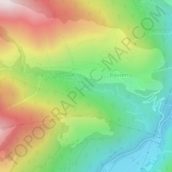
Name: Moron topographic map, elevation, terrain.

Location: Moron, Bausen, Val d'Aran, Lleida, Catalonia, 25549, Spain (42.82303 0.69939 42.84303 0.71939)

Average elevation: 3,478 ft

Minimum elevation: 1,991 ft

Maximum elevation: 5,627 ft

Gear up for your next adventure:

👓Polarized Sunglasses - Outdoor sunglasses for glare reduction
🌡️Portable Weather Meter - Track weather conditions on the trail
👖Convertible Hiking Pants - Versatile zip-off pants for changing altitudes and temperatures
🪶Paracord Bracelet - Survival bracelet with built‑in tools
🦺Reflective Outdoor Gear - Safety gear for low‑light conditions

As an Amazon Associate, this site earns from qualifying purchases at no extra cost to you.