
Make a donation
Gear up for your next adventure:
As an Amazon Associate, this site earns from qualifying purchases at no extra cost to you.
Bull Shoals Lake topographic map
Click on the map to display elevation.
Make a donation
Gear up for your next adventure:
As an Amazon Associate, this site earns from qualifying purchases at no extra cost to you.
Bull Shoals Lake
Bull Shoals Lake impounds the White River for the last time as water travels toward its mouth on the Mississippi River. Bull Shoals is thus the lake farthest downstream in a chain of four artificial lakes that include (from upstream to downstream) Beaver Lake, Table Rock Lake and Lake Taneycomo. The lake is controlled by the Army Corps of Engineers and has the primary purpose of flood control. The level of the lake fluctuates regularly with a normal pool level elevation of 654 feet above sea level, which is locally known as powerpool. However, the lake regularly fluctuates between an elevation of 630 to 680 feet. The upper part of the lake, below nearby Powersite Dam, is known as the "Pothole".
Make a donation
Gear up for your next adventure:
As an Amazon Associate, this site earns from qualifying purchases at no extra cost to you.
About this map
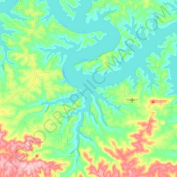
Name: Bull Shoals Lake topographic map, elevation, terrain.
Average elevation: 807 ft
Minimum elevation: 620 ft
Maximum elevation: 1,280 ft
Make a donation
Gear up for your next adventure:
As an Amazon Associate, this site earns from qualifying purchases at no extra cost to you.