
Thank you for supporting this site ❤️
Make a donation
Make a donation
Gear up for your next adventure:
As an Amazon Associate, this site earns from qualifying purchases at no extra cost to you.
Gangrar topographic map
Click on the map to display elevation.
Thank you for supporting this site ❤️
Make a donation
Make a donation
Gear up for your next adventure:
As an Amazon Associate, this site earns from qualifying purchases at no extra cost to you.
About this map
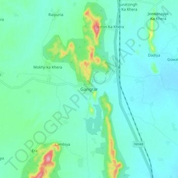
Name: Gangrar topographic map, elevation, terrain.
Location: Gangrar, Gangrar Tehsil, Chittorgarh, Rajasthan, 312900, India (25.01145 74.57015 25.09145 74.65015)
Average elevation: 1,404 ft
Minimum elevation: 1,306 ft
Maximum elevation: 1,857 ft
Thank you for supporting this site ❤️
Make a donation
Make a donation
Gear up for your next adventure:
As an Amazon Associate, this site earns from qualifying purchases at no extra cost to you.