
Pederstrup topographic map
Interactive map
Click on the map to display elevation.
About this map
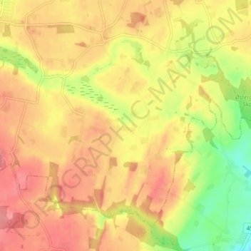
Name: Pederstrup topographic map, elevation, terrain.
Average elevation: 210 ft
Minimum elevation: 43 ft
Maximum elevation: 318 ft
Other topographic maps
Click on a map to view its topography, its elevation and its terrain.
Pederstrup
Denmark > Central Denmark Region > Pederstrup
Pederstrup, Viborg Municipality, Central Denmark Region, Denmark
Average elevation: 72 ft