Geolocate

Wawa topographic map

Click on the map to display elevation.

About this map

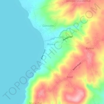
Name: Wawa topographic map, elevation, terrain.

Location: Wawa, Tanauan, Batangas, Calabarzon, 4232, Philippines (14.04413 121.05620 14.08413 121.09620)

Average elevation: 197 ft

Minimum elevation: 0 ft

Maximum elevation: 522 ft

Gear up for your next adventure:

Solar GPS Watches - Advanced multisport watches with built-in topographic maps
🔦Powerful Headlamps - Ultra-bright hands-free lighting for night navigation
🪶Compact Camp Shovel - Folding shovel for campsite tasks
🔦Compact Flashlight - Reliable flashlight for emergencies
🗺️NatGeo Topo Maps - High-quality waterproof printed topographic maps of US Parks

As an Amazon Associate, this site earns from qualifying purchases at no extra cost to you.