Geolocate

Spring Mills topographic map

Click on the map to display elevation.

About this map
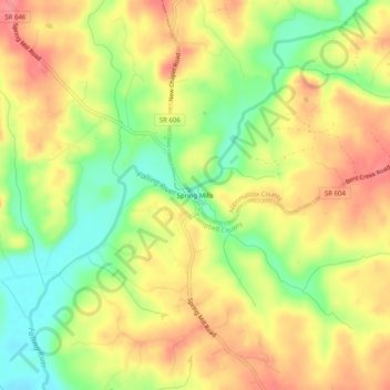
Name: Spring Mills topographic map, elevation, terrain.

Location: Spring Mills, Appomattox County, Virginia, United States (37.22515 -78.93918 37.26515 -78.89918)

Average elevation: 610 ft

Minimum elevation: 466 ft

Maximum elevation: 728 ft

Appomattox County trails, hiking, mountain biking, running and outdoor activities

Other topographic maps

Click on a map to view its topography, its elevation and its terrain.

Pamplin City

United States > Virginia > Appomattox County

Average elevation: 643 ft

Gear up for your next adventure:

📚USA Hiking Guide Books - Top trail guides and map books
🛡️Insect Repellent - Protection against bugs during outdoor activities
😴Insulated Sleeping Pads - Compact and warm pads for high-elevation camping
🌡️Handheld Weather Meters - Measure wind, temp, and pressure for safe mountain travel
📷Action Cameras - Rugged cameras to document your journeys across rugged terrain

As an Amazon Associate, this site earns from qualifying purchases at no extra cost to you.