Geolocate

Ham topographic map

Click on the map to display elevation.

About this map

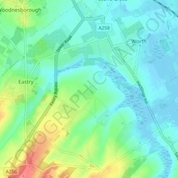
Name: Ham topographic map, elevation, terrain.

Location: Ham, Eastry, Dover, Kent, England, CT14 0EB, United Kingdom (51.22549 1.31025 51.26549 1.35025)

Average elevation: 52 ft

Minimum elevation: -10 ft

Maximum elevation: 197 ft

Gear up for your next adventure:

🎒Waterproof Dry Bags - Keep your electronics and maps dry inside your pack
🏥Hiking First Aid Kits - Comprehensive medical kits for remote trail injuries
🧭Orienteering Set - Complete compass and map reading kit
🎁Geography Themed Gifts - Unique gift ideas for map lovers and geography enthusiasts
🔥Fast-Boil Camping Stoves - Efficient cooking systems for quick trail meals

As an Amazon Associate, this site earns from qualifying purchases at no extra cost to you.