Geolocate

Lipit Sur topographic map

Click on the map to display elevation.

About this map

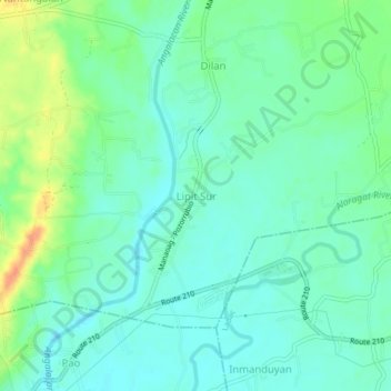
Name: Lipit Sur topographic map, elevation, terrain.

Location: Lipit Sur, Pangasinan, Ilocos Region, 2430, Philippines (16.04700 120.49920 16.08700 120.53920)

Average elevation: 98 ft

Minimum elevation: 56 ft

Maximum elevation: 197 ft

Gear up for your next adventure:

🚁Photography Drones - Capture stunning aerial views of landforms and topography
🧭Orienteering Set - Complete compass and map reading kit
🔦Compact Flashlight - Reliable flashlight for emergencies
🌄Hiking Binoculars - Compact binoculars for scenic views and trail spotting
🌡️Portable Weather Meter - Track weather conditions on the trail

As an Amazon Associate, this site earns from qualifying purchases at no extra cost to you.