
Thank you for supporting this site ❤️
Make a donation
Make a donation
Gear up for your next adventure:
As an Amazon Associate, this site earns from qualifying purchases at no extra cost to you.
Panamaram topographic map
Click on the map to display elevation.
Thank you for supporting this site ❤️
Make a donation
Make a donation
Gear up for your next adventure:
As an Amazon Associate, this site earns from qualifying purchases at no extra cost to you.
About this map
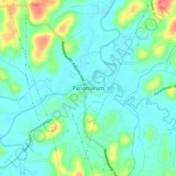
Name: Panamaram topographic map, elevation, terrain.
Location: Panamaram, Mananthavady, Wayanad, Kerala, 670721, India (11.70039 76.03377 11.78039 76.11377)
Average elevation: 2,415 ft
Minimum elevation: 2,339 ft
Maximum elevation: 2,710 ft
Thank you for supporting this site ❤️
Make a donation
Make a donation
Gear up for your next adventure:
As an Amazon Associate, this site earns from qualifying purchases at no extra cost to you.