
Thank you for supporting this site ❤️
Make a donation
Make a donation
Gear up for your next adventure:
As an Amazon Associate, this site earns from qualifying purchases at no extra cost to you.
Ayora topographic map
Click on the map to display elevation.
Thank you for supporting this site ❤️
Make a donation
Make a donation
Gear up for your next adventure:
As an Amazon Associate, this site earns from qualifying purchases at no extra cost to you.
About this map
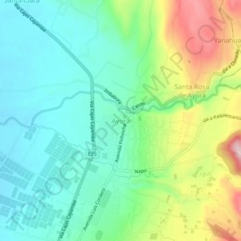
Name: Ayora topographic map, elevation, terrain.
Location: Ayora, Cayambe, Pichincha, 1710002, Ecuador (0.04996 -78.15523 0.08996 -78.11523)
Average elevation: 9,403 ft
Minimum elevation: 9,124 ft
Maximum elevation: 10,023 ft
Thank you for supporting this site ❤️
Make a donation
Make a donation
Gear up for your next adventure:
As an Amazon Associate, this site earns from qualifying purchases at no extra cost to you.