
Thank you for supporting this site ❤️
Make a donation
Make a donation
Gear up for your next adventure:
As an Amazon Associate, this site earns from qualifying purchases at no extra cost to you.
Kolhara topographic map
Click on the map to display elevation.
Thank you for supporting this site ❤️
Make a donation
Make a donation
Gear up for your next adventure:
As an Amazon Associate, this site earns from qualifying purchases at no extra cost to you.
About this map
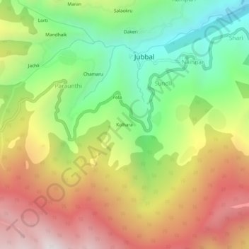
Name: Kolhara topographic map, elevation, terrain.
Location: Kolhara, Jubbal, Shimla, Himachal Pradesh, 171205, India (31.07713 77.64135 31.11713 77.68135)
Average elevation: 7,753 ft
Minimum elevation: 5,817 ft
Maximum elevation: 9,951 ft
Thank you for supporting this site ❤️
Make a donation
Make a donation
Gear up for your next adventure:
As an Amazon Associate, this site earns from qualifying purchases at no extra cost to you.