Geolocate

Kempsey topographic map

Click on the map to display elevation.

About this map

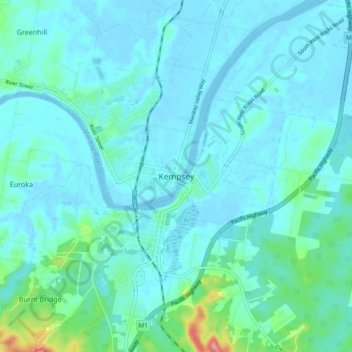
Name: Kempsey topographic map, elevation, terrain.

Location: Kempsey, Kempsey Shire Council, New South Wales, Australia (-31.11981 152.80229 -31.03981 152.88229)

Average elevation: 49 ft

Minimum elevation: -16 ft

Maximum elevation: 384 ft

Gear up for your next adventure:

💧Water Filtration Bottles - Safely drink from streams and lakes while exploring
🔦Compact Flashlight - Reliable flashlight for emergencies
🖼️Topo Map Wall Art - Decorative topographic prints of famous peaks and regions
🗺️Topographic Maps - Detailed topo maps for hiking, exploring and outdoor navigation
😴Insulated Sleeping Pads - Compact and warm pads for high-elevation camping

As an Amazon Associate, this site earns from qualifying purchases at no extra cost to you.