
El Metouia topographic map
Interactive map
Click on the map to display elevation.
About this map
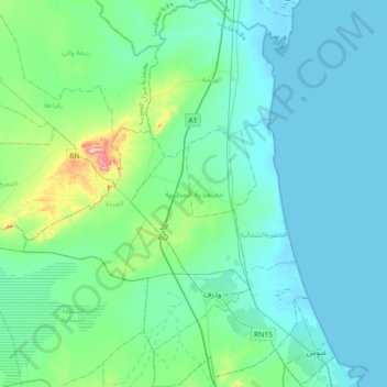
Name: El Metouia topographic map, elevation, terrain.
Location: El Metouia, Gabès, 6052, Tunisie (33.91195 9.79097 34.21114 10.05709)
Average elevation: 121 ft
Minimum elevation: -7 ft
Maximum elevation: 889 ft
Other topographic maps
Click on a map to view its topography, its elevation and its terrain.