Geolocate

Herrán topographic map

Click on the map to display elevation.

About this map

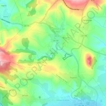
Name: Herrán topographic map, elevation, terrain.

Location: Herrán, Santillana del Mar, Cantabria, 39360, Spain (43.36202 -4.13062 43.40202 -4.09062)

Average elevation: 358 ft

Minimum elevation: 92 ft

Maximum elevation: 791 ft

Gear up for your next adventure:

🪶Compact Camp Shovel - Folding shovel for campsite tasks
🥾Men's Hiking Boots - Durable, waterproof footwear for rugged terrain and steep inclines
😴Insulated Sleeping Pads - Compact and warm pads for high-elevation camping
🦟Ultrasonic Repellers - Create a bug-free zone at your camp or rest stop
🪶Camp Gear Gift Set - Perfect gift bundle for outdoor fans

As an Amazon Associate, this site earns from qualifying purchases at no extra cost to you.