
Thank you for supporting this site ❤️
Make a donation
Make a donation
Gear up for your next adventure:
As an Amazon Associate, this site earns from qualifying purchases at no extra cost to you.
Texmola topographic map
Click on the map to display elevation.
Thank you for supporting this site ❤️
Make a donation
Make a donation
Gear up for your next adventure:
As an Amazon Associate, this site earns from qualifying purchases at no extra cost to you.
About this map
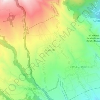
Name: Texmola topographic map, elevation, terrain.
Location: Texmola, Mariano Escobedo, Veracruz, 75540, México (18.91556 -97.26472 18.95556 -97.22472)
Average elevation: 9,167 ft
Minimum elevation: 8,323 ft
Maximum elevation: 10,262 ft
Thank you for supporting this site ❤️
Make a donation
Make a donation
Gear up for your next adventure:
As an Amazon Associate, this site earns from qualifying purchases at no extra cost to you.