
Thank you for supporting this site ❤️
Make a donation
Make a donation
Gear up for your next adventure:
As an Amazon Associate, this site earns from qualifying purchases at no extra cost to you.
Obereschlbach topographic map
Click on the map to display elevation.
Thank you for supporting this site ❤️
Make a donation
Make a donation
Gear up for your next adventure:
As an Amazon Associate, this site earns from qualifying purchases at no extra cost to you.
About this map
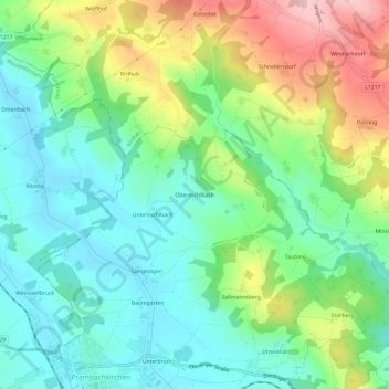
Name: Obereschlbach topographic map, elevation, terrain.
Location: Obereschlbach, Prambachkirchen, Bezirk Eferding, 4731, Austria (48.31519 13.90173 48.35519 13.94173)
Average elevation: 1,411 ft
Minimum elevation: 1,168 ft
Maximum elevation: 1,900 ft
Thank you for supporting this site ❤️
Make a donation
Make a donation
Gear up for your next adventure:
As an Amazon Associate, this site earns from qualifying purchases at no extra cost to you.