
Rădăuți topographic map
Interactive map
Click on the map to display elevation.
About this map
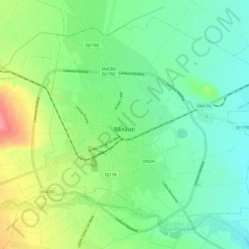
Name: Rădăuți topographic map, elevation, terrain.
Location: Rădăuți, Suceava, 725400, Romania (47.81762 25.88175 47.87670 25.98307)
Average elevation: 1,227 ft
Minimum elevation: 1,132 ft
Maximum elevation: 1,427 ft
Rădăuți is situated in Bukovina, on a plain between the Suceava and Sucevița rivers, 37 km (23 mi) northwest from Suceava, the county capital. The city is located in the depression with the same name, at 375 metres (410 yards) altitude. It is one of the oldest settlements in Moldavia, known since the 15th century. The towns of Siret, Solca, Milișăuți, and Vicovu de Sus are located relatively close to the city, in the Rădăuți urban area of influence.
Other topographic maps
Click on a map to view its topography, its elevation and its terrain.