
Thank you for supporting this site ❤️
Make a donation
Make a donation
Gear up for your next adventure:
As an Amazon Associate, this site earns from qualifying purchases at no extra cost to you.
Bucovina topographic map
Click on the map to display elevation.
Thank you for supporting this site ❤️
Make a donation
Make a donation
Gear up for your next adventure:
As an Amazon Associate, this site earns from qualifying purchases at no extra cost to you.
About this map
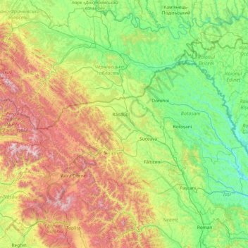
Name: Bucovina topographic map, elevation, terrain.
Location: Bucovina, Iaslovăț, Suceava, 727320, Romania (46.75511 24.96014 48.75511 26.96014)
Average elevation: 1,732 ft
Minimum elevation: 135 ft
Maximum elevation: 7,159 ft
Thank you for supporting this site ❤️
Make a donation
Make a donation
Gear up for your next adventure:
As an Amazon Associate, this site earns from qualifying purchases at no extra cost to you.