Geolocate

Albany topographic map

Click on the map to display elevation.

About this map

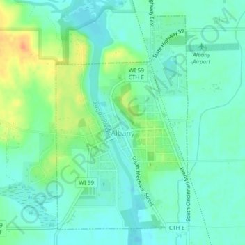
Name: Albany topographic map, elevation, terrain.

Location: Albany, Green County, Wisconsin, 53502, United States (42.69733 -89.44687 42.72089 -89.42703)

Average elevation: 830 ft

Minimum elevation: 791 ft

Maximum elevation: 922 ft

Green County trails, hiking, mountain biking, running and outdoor activities

Other topographic maps

Click on a map to view its topography, its elevation and its terrain.

Brodhead Dam

United States > Wisconsin > Green County

Average elevation: 827 ft

Juda

United States > Wisconsin > Green County

Average elevation: 902 ft

Attica

United States > Wisconsin > Green County

Average elevation: 876 ft

Dayton

United States > Wisconsin > Green County

Average elevation: 869 ft

Twin Grove

United States > Wisconsin > Green County

Average elevation: 991 ft

Stearns

United States > Wisconsin > Green County

Average elevation: 1,027 ft

Ross Crossing

United States > Wisconsin > Green County

Average elevation: 919 ft

Postville

United States > Wisconsin > Green County

Average elevation: 1,086 ft

Oakley

United States > Wisconsin > Green County

Average elevation: 915 ft

Martintown

United States > Wisconsin > Green County

Average elevation: 827 ft

Gear up for your next adventure:

🛰️Satellite Messengers - Emergency SOS and two-way messaging for off-grid adventures
🪶Wildlife Field Guides - Learn animal tracking and species ID
🔭Stargazing Telescopes - Perfect for camping in low-light pollution areas shown on maps
👟Men's Trail Runners - Lightweight footwear for fast-paced exploration and light hiking
🏫Relief Map Kits - Hands-on tools for teaching landforms and elevation

As an Amazon Associate, this site earns from qualifying purchases at no extra cost to you.