
南盘江镇 topographic map
Interactive map
Click on the map to display elevation.
About this map
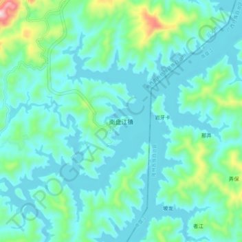
Name: 南盘江镇 topographic map, elevation, terrain.
Location: 南盘江镇, 兴义市, 黔西南布依族苗族自治州, 贵州省, 中国 (24.82685 104.98593 24.90685 105.06593)
Average elevation: 2,743 ft
Minimum elevation: 2,448 ft
Maximum elevation: 4,209 ft
Other topographic maps
Click on a map to view its topography, its elevation and its terrain.