
Rondout topographic map
Click on the map to display elevation.
About this map
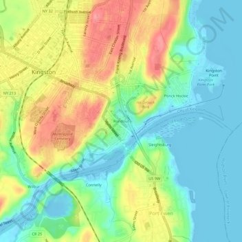
Name: Rondout topographic map, elevation, terrain.
Average elevation: 115 ft
Minimum elevation: -36 ft
Maximum elevation: 302 ft
Ulster County trails, hiking, mountain biking, running and outdoor activities
Other topographic maps
Click on a map to view its topography, its elevation and its terrain.
Sojourner Truth State Park
United States > New York > Ulster County > City of Kingston > East Kingston
Average elevation: 125 ft