
Thank you for supporting this site ❤️
Make a donation
Make a donation
Gear up for your next adventure:
As an Amazon Associate, this site earns from qualifying purchases at no extra cost to you.
Brekoc topographic map
Click on the map to display elevation.
Thank you for supporting this site ❤️
Make a donation
Make a donation
Gear up for your next adventure:
As an Amazon Associate, this site earns from qualifying purchases at no extra cost to you.
About this map
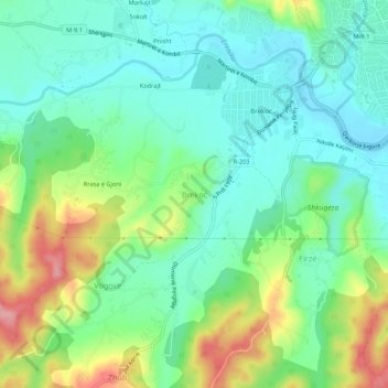
Name: Brekoc topographic map, elevation, terrain.
Location: Brekoc, Municipality of Gjakova, 50000, Kosovo (42.33909 20.38591 42.37909 20.42591)
Average elevation: 1,250 ft
Minimum elevation: 1,115 ft
Maximum elevation: 1,535 ft
Thank you for supporting this site ❤️
Make a donation
Make a donation
Gear up for your next adventure:
As an Amazon Associate, this site earns from qualifying purchases at no extra cost to you.