
Thank you for supporting this site ❤️
Make a donation
Make a donation
Gear up for your next adventure:
As an Amazon Associate, this site earns from qualifying purchases at no extra cost to you.
Viharahena topographic map
Click on the map to display elevation.
Thank you for supporting this site ❤️
Make a donation
Make a donation
Gear up for your next adventure:
As an Amazon Associate, this site earns from qualifying purchases at no extra cost to you.
About this map
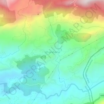
Name: Viharahena topographic map, elevation, terrain.
Location: Viharahena, Matara District, Southern Province, Sri Lanka (6.34759 80.57440 6.38759 80.61440)
Average elevation: 2,014 ft
Minimum elevation: 1,217 ft
Maximum elevation: 3,747 ft
Thank you for supporting this site ❤️
Make a donation
Make a donation
Gear up for your next adventure:
As an Amazon Associate, this site earns from qualifying purchases at no extra cost to you.