
Thank you for supporting this site ❤️
Make a donation
Make a donation
Gear up for your next adventure:
As an Amazon Associate, this site earns from qualifying purchases at no extra cost to you.
Lago del Turano topographic map
Click on the map to display elevation.
Thank you for supporting this site ❤️
Make a donation
Make a donation
Gear up for your next adventure:
As an Amazon Associate, this site earns from qualifying purchases at no extra cost to you.
About this map
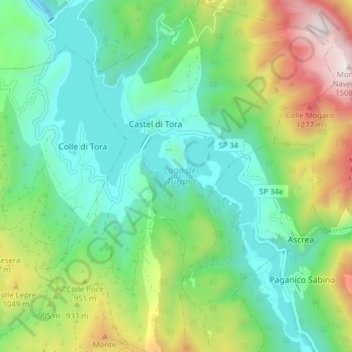
Name: Lago del Turano topographic map, elevation, terrain.
Location: Lago del Turano, Castel di Tora, Rieti, Lazio, Italia (42.17759 12.94023 42.23565 12.99931)
Average elevation: 2,602 ft
Minimum elevation: 1,581 ft
Maximum elevation: 4,928 ft
Thank you for supporting this site ❤️
Make a donation
Make a donation
Gear up for your next adventure:
As an Amazon Associate, this site earns from qualifying purchases at no extra cost to you.