Geolocate

Rundu topographic map

Click on the map to display elevation.

About this map
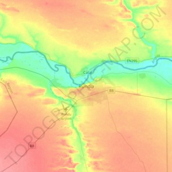
Name: Rundu topographic map, elevation, terrain.

Location: Rundu, Kavango East, Namibia (-18.07372 19.60725 -17.75372 19.92725)

Average elevation: 3,619 ft

Minimum elevation: 3,474 ft

Maximum elevation: 3,757 ft

Gear up for your next adventure:

🦺Reflective Outdoor Gear - Safety gear for low‑light conditions
🪵Folding Camp Saw - Compact saw for wood and campsite work
🌐World Map Poster - Decorative world maps with topographic info
📚USA Hiking Guide Books - Top trail guides and map books
🍳Camping Cook Set - Complete cookware for outdoor meals

As an Amazon Associate, this site earns from qualifying purchases at no extra cost to you.