Geolocate

Rundu topographic map

Click on the map to display elevation.

About this map

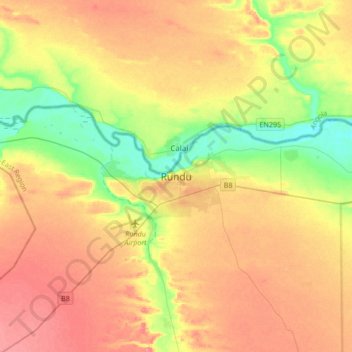
Name: Rundu topographic map, elevation, terrain.

Location: Rundu, Kavango East, Namibia (-18.07372 19.60725 -17.75372 19.92725)

Average elevation: 3,619 ft

Minimum elevation: 3,474 ft

Maximum elevation: 3,757 ft

Gear up for your next adventure:

📶Vehicle Signal Boosters - Improve reception in rural areas while driving to trailheads
💧Water Purification System - Clean water on the trail with reliable purifiers
🪶Camping Sleeping Pad - Comfortable sleeping pad for backpacking
🔦LED Headlamp - Bright and durable LED headlamp for night navigation
🥩Freeze-Dried Meals - Nutritious and lightweight food for remote expeditions

As an Amazon Associate, this site earns from qualifying purchases at no extra cost to you.