Geolocate

Steinkopf topographic map

Click on the map to display elevation.

About this map

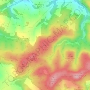
Name: Steinkopf topographic map, elevation, terrain.

Location: Steinkopf, Eisenach, Wartburgkreis, Thuringia, 99834, Germany (50.97870 10.19943 50.97880 10.19953)

Average elevation: 1,010 ft

Minimum elevation: 719 ft

Maximum elevation: 1,270 ft

Gear up for your next adventure:

🥾Men's Hiking Boots - Durable, waterproof footwear for rugged terrain and steep inclines
🛏️Cold Weather Sleeping Bag - Warm sleeping bag for cold conditions
🪶Compact Camp Shovel - Folding shovel for campsite tasks
🌲Outdoor Survival Books - Best books on survival skills
🛡️Insect Repellent - Protection against bugs during outdoor activities

As an Amazon Associate, this site earns from qualifying purchases at no extra cost to you.