
Graaff-Reinet topographic map
Click on the map to display elevation.
About this map
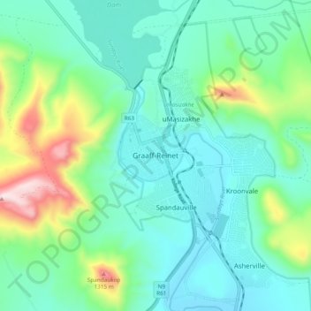
Name: Graaff-Reinet topographic map, elevation, terrain.
Average elevation: 2,864 ft
Minimum elevation: 2,349 ft
Maximum elevation: 4,580 ft
Other topographic maps
Click on a map to view its topography, its elevation and its terrain.
Nqweba Dam
South Africa > Eastern Cape > Sarah Baartman District Municipality > Camdeboo Local Municipality > Graaf-Reinet
Average elevation: 2,674 ft
Camdeboo National Park
South Africa > Eastern Cape > Sarah Baartman District Municipality > Camdeboo Local Municipality
The park is located on the southern foothills of the Sneeuberg Mountain ranges, with an elevation of between 740 and 1480 metres above sea level.
Average elevation: 2,746 ft
Junction 6
South Africa > Eastern Cape > Sarah Baartman District Municipality > Camdeboo Local Municipality
Average elevation: 2,621 ft