
Thank you for supporting this site ❤️
Make a donation
Make a donation
Gear up for your next adventure:
As an Amazon Associate, this site earns from qualifying purchases at no extra cost to you.
Madenler topographic map
Click on the map to display elevation.
Thank you for supporting this site ❤️
Make a donation
Make a donation
Gear up for your next adventure:
As an Amazon Associate, this site earns from qualifying purchases at no extra cost to you.
About this map
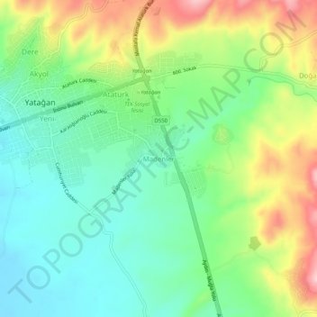
Name: Madenler topographic map, elevation, terrain.
Location: Madenler, Yatağan, Muğla, Aegean Region, 48500, Turkey (37.31442 28.13835 37.35442 28.17835)
Average elevation: 1,352 ft
Minimum elevation: 1,106 ft
Maximum elevation: 1,801 ft
Thank you for supporting this site ❤️
Make a donation
Make a donation
Gear up for your next adventure:
As an Amazon Associate, this site earns from qualifying purchases at no extra cost to you.