
石柱县 topographic map
Interactive map
Click on the map to display elevation.
About this map
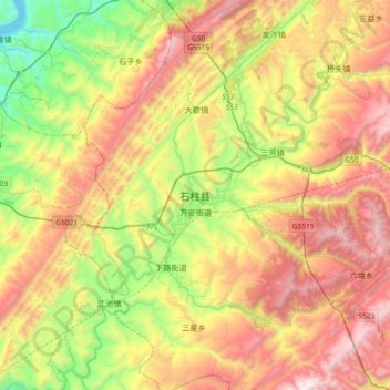
Name: 石柱县 topographic map, elevation, terrain.
Location: 石柱县, 南宾街道, 石柱土家族自治县, 渝东南武陵山区城镇群区位, 重庆市, 中国 (29.84194 107.94912 30.16194 108.26912)
Average elevation: 2,917 ft
Minimum elevation: 387 ft
Maximum elevation: 5,942 ft
Other topographic maps
Click on a map to view its topography, its elevation and its terrain.