
Cumberland House topographic map
Interactive map
Click on the map to display elevation.
About this map
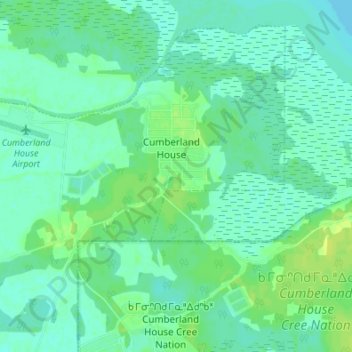
Name: Cumberland House topographic map, elevation, terrain.
Average elevation: 879 ft
Minimum elevation: 863 ft
Maximum elevation: 906 ft
Other topographic maps
Click on a map to view its topography, its elevation and its terrain.
Bell Island
Canada > Saskatchewan > Cumberland House
Bell Island, 123, Cumberland House, Census Division No. 18, Saskatchewan, Canada
Average elevation: 879 ft
Bigstone Cutoff
Canada > Saskatchewan > Cumberland House
Bigstone Cutoff, 123, Cumberland House, Census Division No. 18, Saskatchewan, Canada
Average elevation: 876 ft