Geolocate

Commissary Corner topographic map

Click on the map to display elevation.

About this map

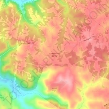
Name: Commissary Corner topographic map, elevation, terrain.

Location: Commissary Corner, Boone County, Kentucky, United States (38.98867 -84.80384 39.02867 -84.76384)

Average elevation: 771 ft

Minimum elevation: 502 ft

Maximum elevation: 902 ft

Other topographic maps

Click on a map to view its topography, its elevation and its terrain.

Burlington

United States > Kentucky > Boone County

Average elevation: 820 ft

Walton

United States > Kentucky > Boone County

Average elevation: 866 ft

Walton

United States > Kentucky > Boone County

Average elevation: 866 ft

Gear up for your next adventure:

🛡️Insect Repellent - Protection against bugs during outdoor activities
🛰️Satellite Messengers - Emergency SOS and two-way messaging for off-grid adventures
🪑Ultralight Camp Chairs - Portable seating for resting after a long day of mapping
🔋Solar Power Banks - Keep your GPS and phone charged in remote wilderness areas
🪄Magnetic Compass - Accurate compass for navigation

As an Amazon Associate, this site earns from qualifying purchases at no extra cost to you.