Geolocate

El Huabo topographic map

Click on the map to display elevation.

About this map

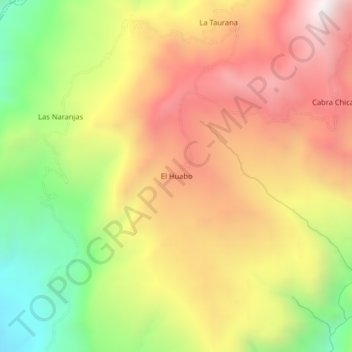
Name: El Huabo topographic map, elevation, terrain.

Location: El Huabo, Pucará, Jaén, Cajamarca, Perú (-6.01311 -79.14841 -5.97311 -79.10841)

Average elevation: 5,604 ft

Minimum elevation: 3,373 ft

Maximum elevation: 7,589 ft

Gear up for your next adventure:

🔭Telescopic Hiking Pole - Adjustable pole for hiking stability
🪄Magnetic Compass - Accurate compass for navigation
📡Handheld GPS Device - Reliable handheld GPS for outdoor navigation
🎒Hydration Pack - Hands‑free water reservoir for long hikes
🥇GPS Hiking Watch - Multi‑sport GPS watch with navigation and trail tracking

As an Amazon Associate, this site earns from qualifying purchases at no extra cost to you.