Geolocate

Bit-os topographic map

Click on the map to display elevation.

About this map

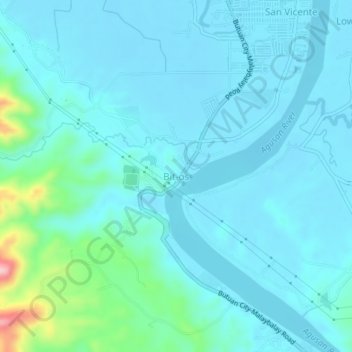
Name: Bit-os topographic map, elevation, terrain.

Location: Bit-os, Butuan, Caraga, Philippines (8.86662 125.52095 8.90662 125.56095)

Average elevation: 95 ft

Minimum elevation: 10 ft

Maximum elevation: 650 ft

Gear up for your next adventure:

🪵Folding Camp Saw - Compact saw for wood and campsite work
🛰️Handheld GPS Units - Professional satellite navigators for precise backcountry mapping
🧭GPS Watch Accessories - Bands and chargers for GPS watches
🧺Microfiber Travel Towels - Compact and fast-drying towels for trail use
🔌Solar Panel Charger - Charge gear sustainably outdoors

As an Amazon Associate, this site earns from qualifying purchases at no extra cost to you.