Geolocate

Enid topographic map

Click on the map to display elevation.

About this map

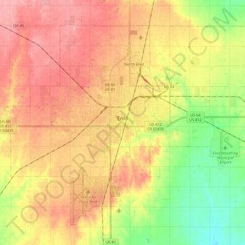
Name: Enid topographic map, elevation, terrain.

Location: Enid, Garfield County, Oklahoma, United States (36.31980 -97.98408 36.46707 -97.76500)

Average elevation: 1,247 ft

Minimum elevation: 1,083 ft

Maximum elevation: 1,375 ft

Garfield County trails, hiking, mountain biking, running and outdoor activities

Gear up for your next adventure:

Backpacking Tent - Lightweight and durable tent for multi‑day hikes
🎒Trail Energy Bars - High‑calorie bars for hiking energy
🗺️NatGeo Topo Maps - High-quality waterproof printed topographic maps of US Parks
🔭Stargazing Telescopes - Perfect for camping in low-light pollution areas shown on maps
📦Gear Storage Bags - Organize and protect outdoor equipment

As an Amazon Associate, this site earns from qualifying purchases at no extra cost to you.