Geolocate

Summerhaven topographic map

Click on the map to display elevation.

About this map

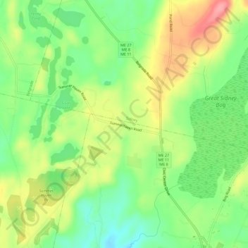
Name: Summerhaven topographic map, elevation, terrain.

Location: Summerhaven, Augusta, Kennebec County, Maine, United States (44.37007 -69.83088 44.41007 -69.79088)

Average elevation: 312 ft

Minimum elevation: 167 ft

Maximum elevation: 492 ft

Maine trails, hiking, mountain biking, running and outdoor activities

Gear up for your next adventure:

📶Satellite Messenger - Communication device off‑grid
🪶Wildlife Field Guides - Learn animal tracking and species ID
🦟Ultrasonic Repellers - Create a bug-free zone at your camp or rest stop
🩳Quick‑Dry Hiking Shorts - Comfortable and quick‑dry shorts for summer hiking
🔭Compact Binoculars - HD vision for scouting terrain and identifying distant landmarks

As an Amazon Associate, this site earns from qualifying purchases at no extra cost to you.