
Kerteh topographic map
Click on the map to display elevation.
About this map
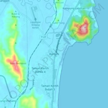
Name: Kerteh topographic map, elevation, terrain.
Location: Kerteh, Kemaman District, Terengganu, 24300, Malaysia (4.46831 103.40180 4.54831 103.48180)
Average elevation: 89 ft
Minimum elevation: -13 ft
Maximum elevation: 1,125 ft
Other topographic maps
Click on a map to view its topography, its elevation and its terrain.
Stadium Mini Mak Chili
Malaysia > Terengganu > Kemaman District > Kampung Kaya
Average elevation: 23 ft
Sungai Kandang Rusa
Malaysia > Terengganu > Kemaman District > Kampung Semayor
Average elevation: 105 ft