
Thank you for supporting this site ❤️
Make a donation
Make a donation
Gear up for your next adventure:
As an Amazon Associate, this site earns from qualifying purchases at no extra cost to you.
Yamunotri topographic map
Click on the map to display elevation.
Thank you for supporting this site ❤️
Make a donation
Make a donation
Gear up for your next adventure:
As an Amazon Associate, this site earns from qualifying purchases at no extra cost to you.
About this map
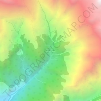
Name: Yamunotri topographic map, elevation, terrain.
Location: Yamunotri, Rajgarhi, Uttarkashi, Uttarakhand, India (30.97921 78.44270 31.01921 78.48270)
Average elevation: 12,113 ft
Minimum elevation: 8,491 ft
Maximum elevation: 16,453 ft
Thank you for supporting this site ❤️
Make a donation
Make a donation
Gear up for your next adventure:
As an Amazon Associate, this site earns from qualifying purchases at no extra cost to you.