Geolocate

Howard topographic map

Click on the map to display elevation.

About this map

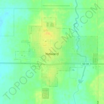
Name: Howard topographic map, elevation, terrain.

Location: Howard, Miner County, South Dakota, 57349, United States (44.00233 -97.54000 44.02021 -97.51027)

Average elevation: 1,558 ft

Minimum elevation: 1,522 ft

Maximum elevation: 1,598 ft

Miner County trails, hiking, mountain biking, running and outdoor activities

Gear up for your next adventure:

🛡️Bear Spray Outdoor - Protection in bear country hikes
🎒Trail Energy Bars - High‑calorie bars for hiking energy
📦Gear Storage Bags - Organize and protect outdoor equipment
🌧️Backpack Rain Cover - Keep gear dry in wet weather
🚗GPS Dash Cams - Record your scenic drives through mountain passes and canyons

As an Amazon Associate, this site earns from qualifying purchases at no extra cost to you.